Trek path: Malavli to Karle by auto, Karle to Bhaje by auto, Bhaje to Lohagadvadi trek, Lohagadvadi to Lohagad by foot with overnight stay in caves, Lohagadvadi to Visapur trek, Visapur to Pavnanagar by foot, Pavnanagar to Karunj by jeep, Karunj to Bedse by foot, Bedse to Kamshet by bus.
Time required:
Malavli to Karle by auto: 15 minutes
Karle village to caves: 30 minutes
Karle to Bhaje by auto: 30 minutes
Bhaje village to caves: 20 minutes
Bhaje to Lohagadvadi trek: 1:30 - 2:00 hours
Lohagadvadi to Lohagad by foot: 30 minutes
Lohagadvadi to Visapur trek: 30 minutes
Visapur to Pavnanagar by foot: 2 hours (we have some doubt about the route we took)
Pavnanagar to Karunj by jeep: 15 minutes
Karunj to Bedse: 30 minutes
Height:
Lohagad: 1000 metres (3300 feet)
Visapur: 1020 metres (3400 feet)
Trekking experience required: Complete novice trek
Fitness required: Since this is a very ordinary trek, it can be carried out by any person of any age and fitness. The only place where fitness counts is if you have planned an overnight stay in the Lohagad caves in which case you should be able to handle cold weather.
Fear factor: Absolutely nil
trek story:
This time on our itinerary was to see the twin forts of Lohagad and Visapur and the triplet caves of Karle, Bhaje and Bedse, which house the ancient Buddhist architectural works. Since this was a long trip, we needed two full days and a very early start to finish everything. As usual we started things off from Kalyan station.
Kalyan to Lonavla:
Being one of the most well-connected railway routes in India, there are about 25 direct connection trains to choose from to cover this lap of the trip. Both Kalyan and Lonavla fall within the famous Mumbai - Pune route which is a heritage route, part of the first railway route built in India. Connecting the country's two busiest hubs, trains during the workdays are packed with office commuters and during the weekend with trekkers. So it is necessary to make a nice clean start and catch the earliest of trains. The answer to this is to catch the Indore-Pune express which leaves Kalyan at 5:20 am. It should reach Lonavla by 7:00 am. It is not at all crowded due to its early timing. However it is difficult for a person who does not live in Kalyan to catch this train. So we had to miss this and take a local to Karjat and from there look for options which would take us to Lonavla. But when we reached Karjat by local, the next train Mumbai - Pune Indrayani express was not too far behind. So we waited for it and boarded it. This train however was filled to brim with weekend traffic and so we had to stand near the door for the entire duration of the commute. However that did allow us to see the Rajmachi forts, which for us was an earlier trek. So we could relive that trek again. Shortly after we reached Lonavla. From here, we spotted a Pune local train which would take us to Malavli, the nearest link to Karle caves. We boarded the local and reached Malavli after a short time.
Malavli to Karle:
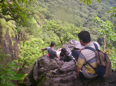
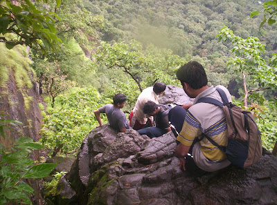
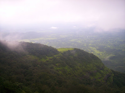
At Malavli, the autos told us that they would take 60 rupees to go to Karle. We were only two and that worked out a bit too much per head. Luckily we met three more trekkers who accompanied us all the way upto the Visapur trek spending the night with us at Lohagad. So the five of us shared one auto, and since we were overloading the auto, we spent 70 rupees at 14 per head. But we soon reached Karle village. From there it was a 15-30 minutes staircase climb to the middle of the mountain upto the rock-cut caves. We climbed very easily and reached the wonderful caves, paying the entry fees of 5 rupees per head. I have to say the main caves with the stupa and all the dwelling niches are in a pretty good condition and were cleaner compared to when I visited them last. However there is a new edifice which has cropped up in front of the cave entrance. The last time I visited the caves, one could see the interiors of the caves from quite a way away. Now however the cave's entrance is blocked by an Ekveera temple. The placing of this temple couldnt have been worse. It blocks the cave view completely. This temple structure is a scar on the face of Karle. Any devotee of Ekveera please forgive me for my blaspheme, but I cant help scorning the placement of this unneeded temple here. The caves now play second fiddle to the temple. The architectures of the caves, the wooden arch beams, the statues and the pillar with four lion heads, each aspect is an architectural wonder. This also goes for the two storeys of rock cut rooms used by the ancient travellers to rest overnight. However the second storey is forbidden for entry to public. The Karle mountain also gives a panoramic view of the mountains and valleys around the Lonavla - Pune region. One can see Lohagad and Visapur forts from distance and a lot of other important forts around this old Shivaji powerhouse. After we decided that it was time to move on and descended down the stairs to catch an auto for Bhaje caves.
Karle to Bhaje:
Once again all five of us crammed into one auto which took 120 rupees at 24 per head. At Bhaje village, we saw signs of a receding rainy season. Waterfalls had reduced to trickles and the rocks were reflecting the sunlight. So it was going to be a tiring climb from the village along the stairs to the caves. It was not too tiring, but it was sweltering and we sweated profusely. But the view from the top and the caves themselves were great. There was not too much of a crowd and there was lot of time and space to explore each of the rock cut rooms. The main room was spacious like any typical Buddhist cave with a giant stupa standing at the far end. There was also a seperate rock cut chamber which was full of miniature stupas. From outside towards one side of the mountain we could see the Mumbai - Pune express highway and the railway tracks nearby. On the other side, we could see Lohagad, with its famous Vinchu Kata (Scorpion's Sting), which is a narrow ledge extending a long way from the mountain and ending into a Buruj (fort bastion). After resting for some time we left for the gentle climb all the way upto Lohagadvadi.
Bhaje to Lohagadvadi:
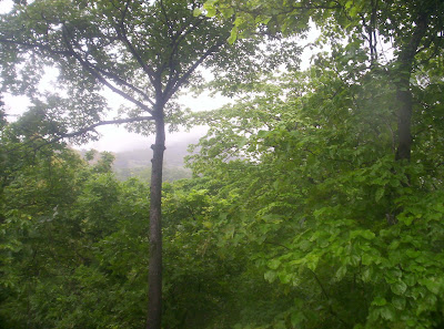
The route from Bhaje caves to Lohagadvadi is a paved path all the way upto the village. It took us about 1:30 to 2:00 hours to complete it. The route is a gentle road and not a typical mountain trek. This is what makes it easy for anyone to reach Lohagad. Along the way, the road gives a breathtaking view of the Valvan lake which has the Valvan dam near Lonavla. After completing the walk we came to the outskirts of Lohagadvadi village where the road overlooks the Lohagad mountain and the Visapur mountain on each side. The path splits into two, one going straight to Lohagadvadi and one branching off left towards Visapur. This point is marked with a stone statue of a cow. So this point is called Gai Mukh Khind (Cow's Face Col). We continued onto Lohagadvadi, setting Visapur aside for the next morning. At Lohagadvadi we had lunch and also waited for some time while our hosts prepared our dinner for our overnight stay at the Lohagad caves. Just before it was evening we set off for Lohagad.
Lohagadvadi to Lohagad:
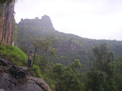
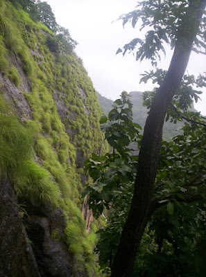
There is proper staircase from Lohagadvadi to Lohagad which leads us through the awesome defence constructions, compact antechambers and a brilliantly breathtaking view of the Pavna lake with Tungi and Tikona forts on its two banks. Lohagad was the place where Marathas stashed away all the loot that they plundered when they invaded Surat. It is rumoured that fortuitous trekkers still find some of the loot every now and then. We never found any. We were blown away by the clever construction of the fort which was highly impregnable if the enemy were to approach from below the mountain. Also mindblowing were the imperious view of Visapur, the massive Pavna lake, Tungi and the pyramid like Tikona. We reached the top after crossing 8 ancient gates.
Lohagad:
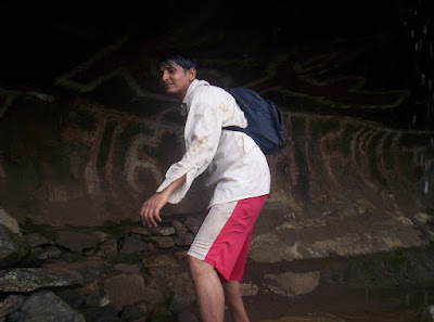
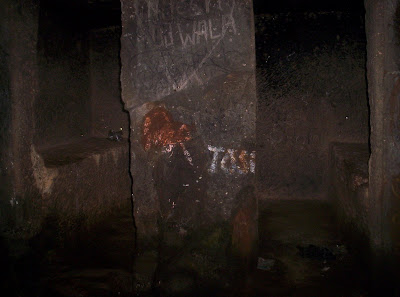
The top was a spacious flat top with a mosque just inside the entrance. We saw a bit around the area and then decided to find a place to stay where we could leave our things and continue onto Vinchu Kata. We found two caves, one of which was really filthy and another one invitingly clean. It seemed like no other trekking group was interesting in an overnight stay so we got a place overlooking the cave entrance. We then moved on towards Vinchu Kata. The path has two lakes along the way and a place which looked like the quarters of the fort-in-charge in those days. Also could be seen was the massive flat top of Visapur mountain. It was likely that the enemy could have attacked Lohagad from Visapur with the help of cannon balls. We could also see the Bhaje caves at a distance below us now. The highway and railways were even further below. The Vinchu Kata looked impressive from some distance. It looked better and better as we approached it. To reach the end, we had to negotiate a small path which ran along the slope of the mountain. Rainy season here would have been a bit risky. We reached the bastion wall and sat on it for a long, long time waiting for the sunset, but instead watching the sun being blocked by the clouds. We also saw a falcon gliding smoothly at a little height above us. One thing here to warn you is that dont carry too many loose things, there are monkeys here waiting to pounce on anything that can be grabbed. Take care of cell phones and cameras. Luckily nothing like that happened to us.
Once we returned, darkness was setting in, so we gathered dry wood and twigs in order to light a campfire to keep us warm. Beside the fire we had our packed dinner, talked for a long time and then went to sleep inside the caves. Every now and then, we would check for intruders or prowlers. Pravin kept himself awake and busy, every now and then rekindling the camp fire by adding more wood, twigs or leaves. Thankfully the fire kept us warm throughout the night.
To Visapur:
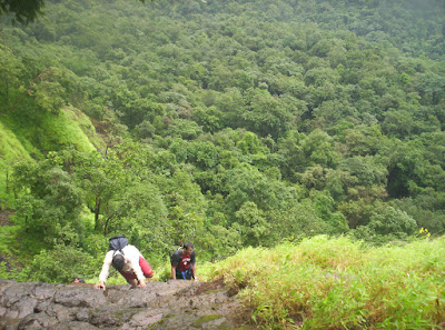
The next morning we got up before sunrise and quickly descended down to Lohagadvadi and had a quick breakfast and tea. We proceeded towards Gai Mukh Khind for the fork towards Visapur. We took the Visapur path and reached the base from where we could trek along a rocky path. Even from below the mountain we saw that this fort had a huge bastion and that the flat area on the top of the mountain could house a whole city. We reached the top pretty easily. The path along Visapur is dotted with a wide variety of wild and colourful flowers, but none more fascinating than the Garvi flower, a bright violet coloured bloom which grows once every seven years. There were lots of them growing on their bushes and littered around on the ground around the bushes. We took about half an hour to reach the summit of Visapur. Here we could see that the flat surface was enormous and expansive. We could put about 20 football fields on the flat plateau-like top of Visapur. One side of the mountain overlooks Lohagad, Tung, Tikona and Pavna lake. The other side which we reached by walking along the perimeter of the mountain overlooked the Bhaje caves, the highway and the railways. And on the third side, the Indrayani river meandered around the valleys of the Sahyadri ranges.
There was a very huge ruined township on top of the Visapur mountain and huge tall bastion all around the mountain to protect from enemies. Recessed in the bastion walls were huge windows for watching over the entire area. The view from the windows was breathtaking and also steep and scary. In the centre of the mountain top was an old Hanuman relief with a water cistern around it. Nearby a small hillock led to the highest point of Lohagad and Visapur put together. From this point, we could see all the way upto Korigad fort, quite a distance away behing the Tung fort. We looked around the massive Visapur fort ruins for a while and when we were done, Pravin, Parag and Ramith parted ways as they had to go home while I and Yogesh decided to move on to Bedse caves.
To Pavnanagar:
From Visapur, maniacally long road took us to a village called Mahagaon and from there we reached Pavnanagar also called Kale Colony. This is the main centre for transport towards Pavna lake from Kamshet railway station and the Express highway. However the path we took upto here from Visapur took us hours and we suspect there must be a shorter way around that we were not told by the localites. It seemed that we came in an arc path instead of a straight line. Anyway we had lunch at Pavnanagar and searched for options to go to Bedse caves.
To Bedse caves:
From Pavnanagar, taxi jeeps are available, which ply towards Kamshet. One has to get down at a village named Karunj from where it is a 2.5 km walk upto Bedse. We got down at Karunj and trudged all the way upto Bedse village from where a new staircase rises all the way to the Bedse caves. The heat was taking its toll on us and we took it really easy instead of our usually high speed trekking that we did throughout the rainy season. But the sight of the caves and its exquisite architecture blew us away and momentarily we forgot our tiredness. The caves seemed very similar to the Karle caves that we had visited a day earlier. The same kind of pillars and stone carvings, the central stupa in the main hall, the dwelling rooms with ancient Brahmi script carvings by travellers. We even found a newly shed snake skin on the floor of one of the rooms. Outside the caves, there were cleverly constructed canals and water cisterns to capture the rain water falling from the mountain top above and collecting it for the drier seasons. The caves are a couple of millenia old, but in extremely good condition and the whole tiresome walk was worth it.
Back Home:
While going back home, we followed the following steps.
* Walk from Bedse to Karunj
* ST bus from Karunj to Kamshet
* Local train from Kamshet to Lonavla
* Indrayani express from Lonavla to Kalyan
All in all I am pretty satisfied with this trek, because we covered 5 locations in 2 days and the view from all these places was great. In fact we found that September - October is the best time to come trekking to Sahyadris, since the pesky rain clouds go away and dont block our view and the green vegetation that looks so beautiful on the hills are still left since the moisture from the monsoon is still not fully dried away.
I will always remember this trek as the most beautiful and photogenic trek of all. So much so that i require a seperate album to display the photos instead of inside this blog itself.
View the photo album here.
Thursday, October 9, 2008
Wednesday, September 17, 2008
First Taste of Rock Climbing: Bhimashankar via Shidi Ghat: 13th-14th September
Trek path: Neral by local train, Neral to Kashele by 10-seater, Kashele to Khandas by 10-seater, Khandas to Bhimashankar via Shidi Ghat.
Time required:
Neral is about 50 minutes from Kalyan by local.
Neral to Kashele - about 30 minutes or more.
Kashele to Khandas - about 30 minutes or more.
Khandas to Bhimashankar via Shidi Ghat - 4 to 5 hours.
and via Ganpati Ghat is about the same time i guess.
Height: 1000 metres (3300 feet)
Trekking experience required: While trekking by Ganpati Ghat is a piece of cake except for the really long time taken, Shidi Ghat requires a fairly seasoned trekker who has done at least 4 to 5 previous simpler treks, since there are huge boulders and flimsy looking ladders to climb and a lot of times all four limbs, shoulders and even your chest and stomach are needed to apply thrust to climb.
Fitness required: Ganpati Ghat needs moderate fitness, but the Shidi Ghat needs a highly fit, fairly strong torso and a well rested overnight body so that you dont lose concentration.
Fear factor: Nothing on Ganpati Ghat, but on Shidi Ghat, there r sheer cliffs and nearly vertical climbs although with plenty of steppable stones and grips. however one wrong move and its a plunge into the valley. Shidi Ghat can be the first stepping stone to rock climbing and a preparation for more thrilling treks like Harishchandragad and Dhak.
trek story:
Our first trek in September was a long standing trek to Bhimashankar which had been planned for quite some time during August but kept getting postponed for one reason or another. This time we made sure that all other plans cud wait and the Bhimashankar trek wud finally get underway. This particular trek was riddled with silly mistakes of a typically unplanned trek, but it was thrilling all the same. To introduce Bhimashankar, it is a mountain town at about 1000m from the sea level and has a Shiva temple, considered among the 12 Jyotirlingas in India, the foremost and the most important of them being in Somnath, Gujarat and also the world-famous Kedarnath, Uttaranchal. But it was not faith that lured us there, it was the trekking challenge presented by the Shidi Ghat, which translated to English means the "stairway pass" or "ladder pass". The Shidi Ghat has imposing boulders, which have to clambering upon using all four limbs and at three places where there is no human way to scale, aluminium / wooden ladders. There is a thrill about this route that attracts trekkers from all over Maharashtra.
To Kalyan station:
Like all my other treks, i left my bike at the Kalyan station's parking lot. Then from Kalyan, with my co-trekkers, Nikhil and Yogesh, caught the 5:30 am train to Karjat.
To Neral:
After about 50 minutes, we arrived at the Neral station. Neral is primarily famous for its route to Matheran. A single line narrow gauge railway line built by the British takes millions of holidayers to Matheran every year. But the prime location of Neral and Karjat at the foothills of the Sahyadris makes them an ideal place for a lot of Sahyadri treks. The availability of cheap local trains from Mumbai makes them very accessible also.
When we got down at Neral, our first silly mistake was obvious, a simple mistake which cost us about two hours of headstart. Instead of getting out of the station's main exit, we got out of an exit way which was completely secluded. In fact, we three were the only people coming out of it. It led to some buildings nearby. But there was no sign of public transport or main road nearby. We spent some precious time walking to the nearest intersection to the main road. But we cud not find a single 10-seater which wud ply towards Kashele for about half-an-hour. Then a nearby 10-seater driver spotted us and called out to us. He then lightly reprimanded us for not coming out through the main exit, from where two 10-seaters had already left for Kashele, during the time we were finding our way to the main road. Then he offered to take us there, but he also wanted to pick up more fares from the next train that wud arrive at the station. So he first took the 10-seater to the station, picked up some people and then started towards Kashele. One point to note here is that a 10-seater in this area can pick up upto 20 people, so be willing to sit tight and adjust, otherwise u will be considered rather unwelcome and have the possibility of being asked for double tariff.
To Kashele:
The ride took between half an hour to 45 minutes. We reached Kashele and had a light breakfast there. Another group who were bound for Bhimashankar got out and were headed to a 10-seater for Khandas. Our earlier mistake cost us here. Had we been on time here, we cud have made it to this 10-seater along with these other trekkers. However it was not to be. Only the three of us wanted to go to Khandas at this time. We cud find no one else who was willing to go there, and the driver of the 10-seater that we hired wanted an exhorbitant price for plying only three. So we waited there for close to an hour until some people (sorry many people, close to 10 or 12) were willing.
To Khandas:
16 of us were huddled in the so-called 10-seater all the 12 km to Khandas. Finally we got there with slightly stiff muscles and spasms after sitting tight all the time for about an hour. In fact, we were eagerly counting down the kilometres every time we saw a milestone. Finally we reached Khandas two hours later that we wud have liked.
Shidi Ghat:
From Khandas, a long path leads off towards the mountains and on the way, the road forks. Taking right we go towards the more mellow but guaranteedly achievable Ganpati Ghat and to the right we go to a place called Kathewadi from where the path to Shidi Ghat starts. Naturally, we took the Kathewadi path and reached the base of the Shidi Ghat.


But the path doesnt have consistent markers and on reaching a brook which ended in a waterfall, we took a wrong diversion and lost our way.
Quite a bit of effort from our wrong diversion cudnt put us back on the right track and we had to come back to the brook.
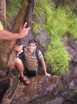
From there we eventually found the right path. With some amount of difficulty we kept on the right course, until we hit upon what we thought was an insurmountable wall. There was small ledge of rock that was taller that we were, and peering above that we thought it was all sheer vertical rock face. The ledge had mossy rock and flowing water. We were pondering whether this was the right path and tried to find a path around the ledge, but to no avail. But then a good thing happened to us. Another group of boys who were from Pune, arrived on the spot and they too were confused about the right path. Since 6 people took the same path, we were fairly convinced that this path was right. One of the boys who was light on luggage decided to scale the ledge and we pushed his thighs through. He went a bit further up and declared that the path was right. When we asked how he cud identify, pat came the reply. There was a ladder propped up against the rock face. So we followed him, climbing the ledge one by one. The ledge gave us an idea of how the climb wud be. The climb wud be such that it dictated more use of hands and shoulders than using stepping of feet. We wud have to prop ourselves up with the sheer strength of shoulders after finding sufficient grip. Legs wud only be used to find difficult footholds or sometimes even be dangling freely in the air.
Huffing and puffing we reached the base of the first of the three ladders. The six of us worked systematically and managed to scale two ladders, in both places taking care that only one person was on a ladder at any instant. The aluminium ladders were bearing the brunt of repeated climbs, with some rungs bent out of shape by weight of trekkers. But since it was aluminium there was no wear and tear due to weather, oxidation or elements. Think TV antennas for example!!! Along with the two ladders, there were places where we reached the corner of a mountain and had to swing ourselves to round the corner from one ledge to another, when the rock face suddenly changed direction.
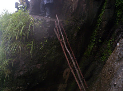


The third ladder is the most thrilling of all though. We reached a flat area from where we cud see that the ladder was on the top of a heap of rocks, which themselves were inclined at an angle. Also, this particular ladder was taller than the rest and seemed to go to some unseen distance above us. But there was another feature here. There was a long niche in the rock face just to the right of the ladder with a waterfall falling over its mouth. We climbed the rocky heap and took some rest inside the niche. The niche was warm compared to the surrounding. We also filled up some water from the waterfall.


Then we continued towards the third ladder. Again this ladder also had crooked aluminium rungs, but along with the aluminium there was a wooden ladders reinforced and tied up along with the aluminium mainstay and it looked more durable. The difficulty was not the ladder though. It was the stop when we reached the top of the ladder. We cud see two huge rocks twice our height and we had to scale it to the reach the top of a plain plateau. All of us worked in a co-ordinated manner to scale the two boulders and reached the plain. I have to say that these two boulders gave me my best trekking pleasure to date. It was almost rock climbing. And they also proved that I in general and my shoulders in particular are very fit.


We reached the top of the plateau which was expansive and had a cultivated area as well, with a tiny village nearby. It was also the location where Shidi Ghat met the Ganpati Ghat. From here the two paths joined and went as one along the Mungi Ghat upto the summit in Bhimashankar. From here we cud see the height still left to scale and cud also see people who started earlier than we had, almost reaching the summit. They looked like ants crawling along the rock wall, hence the name Mungi Ghat (Mungi means ant). Here again we had to rest and ate a little to build up the strength to reach the top.
Mungi Ghat:
The Mungi Ghat is completely uneventful, but a very long winding path upto the summit. Besides it is heavily forested and we walk under a very thick tree cover. It looks dark during day, and at night it is dangerous with nocturnal prowlers. Overall we had a rather tired but uneventful ascent up the Mungi Ghat. But the skies opened up and we got drenched by the time we reached the top.
Bhimashankar summit:
When we reached the summit, it was so clouded that we didnt know that it was the summit. We saw a small moat which had clear water, so again we filled up our bottles thinking that there was a long way to go still. However we saw some cottages and some boards and a paved road and realized that the trek was suddenly over. We reached the town proper and ate some warm snacks and sought out a room. The rest of this blog looks at the various options u have when u reach Bhimashankar.
Sightseeing options:
Of course the Jyotirlinga temple is the first spot that you must consider. In fact, other that trekkers, the common public comes here exactly for that. The temple, though, seems to have had heavy signs of restructuring of walls, entry gate, etc. Its obvious that the entry gate has been shifted as confirmed by the signboard just outside the new entrance. The new entrance has a lot of shops, the most famous among them being the shops selling condensed milk puree (The Marathi word Mawa is obviously easier to say :) ). When consumed warm, it is really tasty, and when kept for too much time, it hardens and is a bit tough to break into pieces.


You can also see a place called Gupt Bhimashankar which is supposed to be the ancient location of the temple. But try to go there when its not raining too much. There is rivulet in between which swells which huge currents of water and you can risk getting swept away. We had to form a human chain to step through it.
Then then there is this place called Nagphani (Cobra's hood), so named due to shape of the rock on the cliff overlooking the plain. This is the highest point on the mountain where Bhimashankar is situated. There is nothing spectacular to watch here other that a splendid view, but the Shidi Ghat offered much more splendid views on the way anyway.
There is a Maruti - Anjani Mata Mandir quite some distance away from the main town as well. This place is infested with monkeys so dont carry anything loose. But the scenic beauty around this temple is spectacular, as we see the Nagphani hill in the backdrop of this temple.

There is a point called Bombay Point, from where I think you can see some of the Mumbai City, but there was simply no way we cud see anywhere through the cloudy haze. Perhaps December might be a good time to revisit this place.
One unrecognized spot here is the view offered by a broken wall in the Bhimashankar bus stop. It offers the same view as the Bombay Point, but in my opinion this angle gives a more expansive view.


Lodging options:
There are local official lodges (called Dharamshalas) at the entrance of Bhimashankar. They are very cheap but seemingly lack basic amenities. They are not too well kept.
There are costly rooms which every facility you can think of. These are overpriced in excess of 700 - 800 rupees and are generally afforded by the more affluent metropolis based trekkers.
There are row houses which have different bedrooms, pricing depending on the number of beds, and a commonly shared toilet. These, in my opinion, are the best trade-off between price and comfort. We took a room with three beds, priced at 500. Warm water was for 10 rupees a bucket.
Unlike other places like Rajmachi, there are no ancient caves or medieval stone cut rest zones here and its absolutely not advised to shelter in the forest at night since there are sightings of nocturnal prowlers.
The best thing wud be to finish off Bhimashankar as a one day trek, reaching very early, sightseeing for a couple of hours, having lunch or tea and leaving. Lodging at Bhimashankar is unnecessary and is an overkill coz there is nothing worth seeing here for more than 2 - 3 hours. If you are having to stay here, then your plans or execution have some flaw somewhere. I cant count the number of mistakes we made coz i dont have that many fingers :). We took the wrong exit at Neral, felt too drowsy to sightsee on the first evening, overslept on the second morning, tried to catch a bus which was eventually cancelled, took a sudden decision to do sight seeing on the second afternoon, .........
Eating options:
The lodges in Bhimashankar dont provide their own food, but there are lots of eateries in Bhimashankar. There are a lot of cuisines to choose from, but the rule of the thumb is, if in doubt, always go for the local flavour, which in case of Bhimashankar is the Maharashtrian cuisine. We also tried Punjabi stuff and it did taste good, I have to admit.
Options for public transport from Bhimashankar:
Bhimashankar is well connected to Pune by bus, one bus every half an hour. Apart from that there is bus to Kalyan at around 7:15 am and a bus for Chembur at 11:30 am. There are also one or two buses to Thane I think. If you want to go to Pune then great, you dont need further reading. But if you want to go to Kalyan, Thane or Mumbai and find the bus timing limiting, then you can pick one of the following options.
Trek back to Khandas via Shidi or Ganpati Ghat and reach Khandas, Kashele and Neral, the same way we arrived. I have never heard of an instance where one has trekked down via Shidi Ghat. It is not for the faint hearted.
The other option is to catch the Pune bus and get down at a stop called Manchar. This takes about 2 hours. From Manchar, catch a bus to Alephata. There are frequent buses, about 1 every 15 minutes. This commute takes about 1 hour. From Alephata there are hundreds of buses per day plying to Kalyan and Mumbai. It takes a good four to six hours though, depending on where you want to go. But the bright side is that you get to go across a scenic ride across another beautiful Ghat, the Malshej Ghat of Nasik district. It takes you across some really tall Sahyadris and there are lots of roadside waterfalls. Waterfalls fall from rock faces on the side of road and drop onto the road itself. You can hear constant banging of water on the bus' rooftop. We followed this option, since we left Bhimashankar at 2pm.
All in all, despite all the mistakes made, this was the most enjoyable trek I have had to this date, especially the Shidi Ghat rock climbing. This trek transformed me from the "stick to safe tried and tested routes" to "Just go for the most thrilling route, no matter, what you are advised" kind of trekker.
We had heard a lot from people about Shidi Ghat being a dangerous beast of a route, but nature was really kind to us, no heavy rain during the ascent, no sliding rocks or boulders, no attacking creatures, no slippery mud, no mishaps, nothing at all. In fact as we were doing the so-called 'fatal' ascent, there were serial bombs ripping through Delhi in an unpredictable man-made terror. At least nature strikes with a lot of warnings. Just like the Delhi bombings, Mumbai bombings, Bangalore bombings, Ahmedabad bombings, blah, blah, blah were all man-made, so are all the mishaps at Shidi Ghat. Trekkers not wearing proper gear, not concentrating hard enough, not being disciplined enough, not being well-prepared and so on. Why blame the path?
So whats the point of all the ill rumours about a wonderfully thrilling trek path, I ask. Traversing the Shidi Ghat is as safe as or as dangerous as living in an Indian metro city. Its all in one's mindset, point of view, attitude and preparation. In both cases, if you look at the positive points and are reasonably careful, you will enjoy and if you look at the negative points, you will live with fear.
Time required:
Neral is about 50 minutes from Kalyan by local.
Neral to Kashele - about 30 minutes or more.
Kashele to Khandas - about 30 minutes or more.
Khandas to Bhimashankar via Shidi Ghat - 4 to 5 hours.
and via Ganpati Ghat is about the same time i guess.
Height: 1000 metres (3300 feet)
Trekking experience required: While trekking by Ganpati Ghat is a piece of cake except for the really long time taken, Shidi Ghat requires a fairly seasoned trekker who has done at least 4 to 5 previous simpler treks, since there are huge boulders and flimsy looking ladders to climb and a lot of times all four limbs, shoulders and even your chest and stomach are needed to apply thrust to climb.
Fitness required: Ganpati Ghat needs moderate fitness, but the Shidi Ghat needs a highly fit, fairly strong torso and a well rested overnight body so that you dont lose concentration.
Fear factor: Nothing on Ganpati Ghat, but on Shidi Ghat, there r sheer cliffs and nearly vertical climbs although with plenty of steppable stones and grips. however one wrong move and its a plunge into the valley. Shidi Ghat can be the first stepping stone to rock climbing and a preparation for more thrilling treks like Harishchandragad and Dhak.
trek story:
Our first trek in September was a long standing trek to Bhimashankar which had been planned for quite some time during August but kept getting postponed for one reason or another. This time we made sure that all other plans cud wait and the Bhimashankar trek wud finally get underway. This particular trek was riddled with silly mistakes of a typically unplanned trek, but it was thrilling all the same. To introduce Bhimashankar, it is a mountain town at about 1000m from the sea level and has a Shiva temple, considered among the 12 Jyotirlingas in India, the foremost and the most important of them being in Somnath, Gujarat and also the world-famous Kedarnath, Uttaranchal. But it was not faith that lured us there, it was the trekking challenge presented by the Shidi Ghat, which translated to English means the "stairway pass" or "ladder pass". The Shidi Ghat has imposing boulders, which have to clambering upon using all four limbs and at three places where there is no human way to scale, aluminium / wooden ladders. There is a thrill about this route that attracts trekkers from all over Maharashtra.
To Kalyan station:
Like all my other treks, i left my bike at the Kalyan station's parking lot. Then from Kalyan, with my co-trekkers, Nikhil and Yogesh, caught the 5:30 am train to Karjat.
To Neral:
After about 50 minutes, we arrived at the Neral station. Neral is primarily famous for its route to Matheran. A single line narrow gauge railway line built by the British takes millions of holidayers to Matheran every year. But the prime location of Neral and Karjat at the foothills of the Sahyadris makes them an ideal place for a lot of Sahyadri treks. The availability of cheap local trains from Mumbai makes them very accessible also.
When we got down at Neral, our first silly mistake was obvious, a simple mistake which cost us about two hours of headstart. Instead of getting out of the station's main exit, we got out of an exit way which was completely secluded. In fact, we three were the only people coming out of it. It led to some buildings nearby. But there was no sign of public transport or main road nearby. We spent some precious time walking to the nearest intersection to the main road. But we cud not find a single 10-seater which wud ply towards Kashele for about half-an-hour. Then a nearby 10-seater driver spotted us and called out to us. He then lightly reprimanded us for not coming out through the main exit, from where two 10-seaters had already left for Kashele, during the time we were finding our way to the main road. Then he offered to take us there, but he also wanted to pick up more fares from the next train that wud arrive at the station. So he first took the 10-seater to the station, picked up some people and then started towards Kashele. One point to note here is that a 10-seater in this area can pick up upto 20 people, so be willing to sit tight and adjust, otherwise u will be considered rather unwelcome and have the possibility of being asked for double tariff.
To Kashele:
The ride took between half an hour to 45 minutes. We reached Kashele and had a light breakfast there. Another group who were bound for Bhimashankar got out and were headed to a 10-seater for Khandas. Our earlier mistake cost us here. Had we been on time here, we cud have made it to this 10-seater along with these other trekkers. However it was not to be. Only the three of us wanted to go to Khandas at this time. We cud find no one else who was willing to go there, and the driver of the 10-seater that we hired wanted an exhorbitant price for plying only three. So we waited there for close to an hour until some people (sorry many people, close to 10 or 12) were willing.
To Khandas:
16 of us were huddled in the so-called 10-seater all the 12 km to Khandas. Finally we got there with slightly stiff muscles and spasms after sitting tight all the time for about an hour. In fact, we were eagerly counting down the kilometres every time we saw a milestone. Finally we reached Khandas two hours later that we wud have liked.
Shidi Ghat:
From Khandas, a long path leads off towards the mountains and on the way, the road forks. Taking right we go towards the more mellow but guaranteedly achievable Ganpati Ghat and to the right we go to a place called Kathewadi from where the path to Shidi Ghat starts. Naturally, we took the Kathewadi path and reached the base of the Shidi Ghat.
But the path doesnt have consistent markers and on reaching a brook which ended in a waterfall, we took a wrong diversion and lost our way.
Quite a bit of effort from our wrong diversion cudnt put us back on the right track and we had to come back to the brook.
From there we eventually found the right path. With some amount of difficulty we kept on the right course, until we hit upon what we thought was an insurmountable wall. There was small ledge of rock that was taller that we were, and peering above that we thought it was all sheer vertical rock face. The ledge had mossy rock and flowing water. We were pondering whether this was the right path and tried to find a path around the ledge, but to no avail. But then a good thing happened to us. Another group of boys who were from Pune, arrived on the spot and they too were confused about the right path. Since 6 people took the same path, we were fairly convinced that this path was right. One of the boys who was light on luggage decided to scale the ledge and we pushed his thighs through. He went a bit further up and declared that the path was right. When we asked how he cud identify, pat came the reply. There was a ladder propped up against the rock face. So we followed him, climbing the ledge one by one. The ledge gave us an idea of how the climb wud be. The climb wud be such that it dictated more use of hands and shoulders than using stepping of feet. We wud have to prop ourselves up with the sheer strength of shoulders after finding sufficient grip. Legs wud only be used to find difficult footholds or sometimes even be dangling freely in the air.
Huffing and puffing we reached the base of the first of the three ladders. The six of us worked systematically and managed to scale two ladders, in both places taking care that only one person was on a ladder at any instant. The aluminium ladders were bearing the brunt of repeated climbs, with some rungs bent out of shape by weight of trekkers. But since it was aluminium there was no wear and tear due to weather, oxidation or elements. Think TV antennas for example!!! Along with the two ladders, there were places where we reached the corner of a mountain and had to swing ourselves to round the corner from one ledge to another, when the rock face suddenly changed direction.
The third ladder is the most thrilling of all though. We reached a flat area from where we cud see that the ladder was on the top of a heap of rocks, which themselves were inclined at an angle. Also, this particular ladder was taller than the rest and seemed to go to some unseen distance above us. But there was another feature here. There was a long niche in the rock face just to the right of the ladder with a waterfall falling over its mouth. We climbed the rocky heap and took some rest inside the niche. The niche was warm compared to the surrounding. We also filled up some water from the waterfall.
Then we continued towards the third ladder. Again this ladder also had crooked aluminium rungs, but along with the aluminium there was a wooden ladders reinforced and tied up along with the aluminium mainstay and it looked more durable. The difficulty was not the ladder though. It was the stop when we reached the top of the ladder. We cud see two huge rocks twice our height and we had to scale it to the reach the top of a plain plateau. All of us worked in a co-ordinated manner to scale the two boulders and reached the plain. I have to say that these two boulders gave me my best trekking pleasure to date. It was almost rock climbing. And they also proved that I in general and my shoulders in particular are very fit.
We reached the top of the plateau which was expansive and had a cultivated area as well, with a tiny village nearby. It was also the location where Shidi Ghat met the Ganpati Ghat. From here the two paths joined and went as one along the Mungi Ghat upto the summit in Bhimashankar. From here we cud see the height still left to scale and cud also see people who started earlier than we had, almost reaching the summit. They looked like ants crawling along the rock wall, hence the name Mungi Ghat (Mungi means ant). Here again we had to rest and ate a little to build up the strength to reach the top.
Mungi Ghat:
The Mungi Ghat is completely uneventful, but a very long winding path upto the summit. Besides it is heavily forested and we walk under a very thick tree cover. It looks dark during day, and at night it is dangerous with nocturnal prowlers. Overall we had a rather tired but uneventful ascent up the Mungi Ghat. But the skies opened up and we got drenched by the time we reached the top.
Bhimashankar summit:
When we reached the summit, it was so clouded that we didnt know that it was the summit. We saw a small moat which had clear water, so again we filled up our bottles thinking that there was a long way to go still. However we saw some cottages and some boards and a paved road and realized that the trek was suddenly over. We reached the town proper and ate some warm snacks and sought out a room. The rest of this blog looks at the various options u have when u reach Bhimashankar.
Sightseeing options:
Of course the Jyotirlinga temple is the first spot that you must consider. In fact, other that trekkers, the common public comes here exactly for that. The temple, though, seems to have had heavy signs of restructuring of walls, entry gate, etc. Its obvious that the entry gate has been shifted as confirmed by the signboard just outside the new entrance. The new entrance has a lot of shops, the most famous among them being the shops selling condensed milk puree (The Marathi word Mawa is obviously easier to say :) ). When consumed warm, it is really tasty, and when kept for too much time, it hardens and is a bit tough to break into pieces.
You can also see a place called Gupt Bhimashankar which is supposed to be the ancient location of the temple. But try to go there when its not raining too much. There is rivulet in between which swells which huge currents of water and you can risk getting swept away. We had to form a human chain to step through it.
Then then there is this place called Nagphani (Cobra's hood), so named due to shape of the rock on the cliff overlooking the plain. This is the highest point on the mountain where Bhimashankar is situated. There is nothing spectacular to watch here other that a splendid view, but the Shidi Ghat offered much more splendid views on the way anyway.
There is a Maruti - Anjani Mata Mandir quite some distance away from the main town as well. This place is infested with monkeys so dont carry anything loose. But the scenic beauty around this temple is spectacular, as we see the Nagphani hill in the backdrop of this temple.
There is a point called Bombay Point, from where I think you can see some of the Mumbai City, but there was simply no way we cud see anywhere through the cloudy haze. Perhaps December might be a good time to revisit this place.
One unrecognized spot here is the view offered by a broken wall in the Bhimashankar bus stop. It offers the same view as the Bombay Point, but in my opinion this angle gives a more expansive view.
Lodging options:
There are local official lodges (called Dharamshalas) at the entrance of Bhimashankar. They are very cheap but seemingly lack basic amenities. They are not too well kept.
There are costly rooms which every facility you can think of. These are overpriced in excess of 700 - 800 rupees and are generally afforded by the more affluent metropolis based trekkers.
There are row houses which have different bedrooms, pricing depending on the number of beds, and a commonly shared toilet. These, in my opinion, are the best trade-off between price and comfort. We took a room with three beds, priced at 500. Warm water was for 10 rupees a bucket.
Unlike other places like Rajmachi, there are no ancient caves or medieval stone cut rest zones here and its absolutely not advised to shelter in the forest at night since there are sightings of nocturnal prowlers.
The best thing wud be to finish off Bhimashankar as a one day trek, reaching very early, sightseeing for a couple of hours, having lunch or tea and leaving. Lodging at Bhimashankar is unnecessary and is an overkill coz there is nothing worth seeing here for more than 2 - 3 hours. If you are having to stay here, then your plans or execution have some flaw somewhere. I cant count the number of mistakes we made coz i dont have that many fingers :). We took the wrong exit at Neral, felt too drowsy to sightsee on the first evening, overslept on the second morning, tried to catch a bus which was eventually cancelled, took a sudden decision to do sight seeing on the second afternoon, .........
Eating options:
The lodges in Bhimashankar dont provide their own food, but there are lots of eateries in Bhimashankar. There are a lot of cuisines to choose from, but the rule of the thumb is, if in doubt, always go for the local flavour, which in case of Bhimashankar is the Maharashtrian cuisine. We also tried Punjabi stuff and it did taste good, I have to admit.
Options for public transport from Bhimashankar:
Bhimashankar is well connected to Pune by bus, one bus every half an hour. Apart from that there is bus to Kalyan at around 7:15 am and a bus for Chembur at 11:30 am. There are also one or two buses to Thane I think. If you want to go to Pune then great, you dont need further reading. But if you want to go to Kalyan, Thane or Mumbai and find the bus timing limiting, then you can pick one of the following options.
Trek back to Khandas via Shidi or Ganpati Ghat and reach Khandas, Kashele and Neral, the same way we arrived. I have never heard of an instance where one has trekked down via Shidi Ghat. It is not for the faint hearted.
The other option is to catch the Pune bus and get down at a stop called Manchar. This takes about 2 hours. From Manchar, catch a bus to Alephata. There are frequent buses, about 1 every 15 minutes. This commute takes about 1 hour. From Alephata there are hundreds of buses per day plying to Kalyan and Mumbai. It takes a good four to six hours though, depending on where you want to go. But the bright side is that you get to go across a scenic ride across another beautiful Ghat, the Malshej Ghat of Nasik district. It takes you across some really tall Sahyadris and there are lots of roadside waterfalls. Waterfalls fall from rock faces on the side of road and drop onto the road itself. You can hear constant banging of water on the bus' rooftop. We followed this option, since we left Bhimashankar at 2pm.
All in all, despite all the mistakes made, this was the most enjoyable trek I have had to this date, especially the Shidi Ghat rock climbing. This trek transformed me from the "stick to safe tried and tested routes" to "Just go for the most thrilling route, no matter, what you are advised" kind of trekker.
We had heard a lot from people about Shidi Ghat being a dangerous beast of a route, but nature was really kind to us, no heavy rain during the ascent, no sliding rocks or boulders, no attacking creatures, no slippery mud, no mishaps, nothing at all. In fact as we were doing the so-called 'fatal' ascent, there were serial bombs ripping through Delhi in an unpredictable man-made terror. At least nature strikes with a lot of warnings. Just like the Delhi bombings, Mumbai bombings, Bangalore bombings, Ahmedabad bombings, blah, blah, blah were all man-made, so are all the mishaps at Shidi Ghat. Trekkers not wearing proper gear, not concentrating hard enough, not being disciplined enough, not being well-prepared and so on. Why blame the path?
So whats the point of all the ill rumours about a wonderfully thrilling trek path, I ask. Traversing the Shidi Ghat is as safe as or as dangerous as living in an Indian metro city. Its all in one's mindset, point of view, attitude and preparation. In both cases, if you look at the positive points and are reasonably careful, you will enjoy and if you look at the negative points, you will live with fear.
Sunday, August 17, 2008
Majestic twin forts: Rajmachi: 15th and 16th August 2008
Trek path: Upto Karjat by local train, from Karjat to Kondivade by 6-seater or from Karjat to Khandape by bus and to Kondivade by 6-seater or walk, from Kondivade to Udhewadi by trekking, from Udhewadi to Shrivardhan / Manranjan forts by trekking.
Time required:
Karjat to Kondivade by 6-seater - 30 minutes or
Karjat to Khandape by bus - 25 minutes and Khandape to Kondivade by walk - 30 minutes
Kondivade to Udhewadi - 3 hours
Udhewadi to Shrivardhan - 30 minutes
Udhewadi to Manranjan - 30 minutes
Height: 813 metres (2710 feet)
Trekking experience required: No experience, this can be a beginner's trek.
Fitness required: Moderate fitness
Fear factor: Nothing upto Udhewadi. The ascent from Udhewadi to Shrivardhan has a stone staircase which has been eroded heavily by rain and can be a bit slippery during monsoon. To the right of the staircase is a very steep and deep ravine dropping straight into the village.
trek story:
India's 61st independence day brought us to the majestic twin forts of Rajmachi situated on the Bhor Ghats. The two forts Shrivardhan and Manranjan overlook each other from two mountains across a valley. Another mountain range across the valley to the east of Manranjan carries the railway tracks running from Mumbai to Pune. You can see the section of tracks running from Thakurwadi and Monkey Hill stations located between Karjat and Khandala. So on one side you see the ancient architectural wonder of strong stone fortresses and on the other side you see the magic of modern technology with strong rails of steel and massive moving boxes of steel which are parts of the most used and the highest revenue generating transport system of current India.
Introducting our new trekkers:
The Rajmachi trek introduces you to a new trekker in the form of Pravin Mohite, along with usual contributors of this blog. Pravin is responsible for most of the photography on this trip since my camera got waterlogged and wont start anymore :( Also coming with us on this trek was Kamal Bisht, but he couldnt complete the trek and left when we were about to reach Udhewadi, since he didnt want to stay overnight.
Upto Karjat by train:
All five of us met up at Kalyan, and from there we boarded the 7:07 am local train for Karjat, which after an uneventful run through the rainy morning reached Karjat at 8:15 am. We alighted and went to the east of the station to get to the Karjat bus stop.
Upto Kondivade by 6-seater:
From here we were to catch the bus to Sandshi and get down at a stop named Khandape. But we were too late and so we missed the bus, and found that the next bus was only at 9:50. That would have been too late and we would only have reached the base of the climb at around 11:00 or so. So we took a 6-seater directly to the base village of Kondivade. But the 6-seater charged us 250 rupees for 5 persons, and it was a rip off. We would like to tell you that you should not catch a 6-seater to Kondivade from Karjat east. Only do so from Karjat west and let all the seats fill up. The driver will tell you that he will take you there immediately without filling up the other seats and quote a price that is too high. But wait for the seats to fill up. The norm is that at Karjat, the seats are 'properly filled up' only when the 6-seater is carrying 12 persons!!! So be ready to adjust and sit squeezed with your bags on your lap!!! But then if that is the case, your fare will go down to Rs 8 per head, instead of the Rs 50 that we had to shell out. The best option would be to learn the timetable of buses in Karjat. Here I put up a reference chart that was put up at the Karjat bus stop itself. Use it as a reference chart for Rajmachi or Dhak Bahiri treks. Also note that the timings are as of 16th August 2008 at the latest. So keep tab on this time table.

Trek upto Kondane caves:
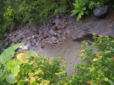
When we reached Kondivade, our 6-seater stopped at a point where the road was broken and unsafe to drive on.We got down and started walking towards the base of the climb. All along the way, the Ulhas river ran parallelly to the path we were walking on.


At one point, there was a section where the road had caved into the river, leaving a very narrow muddy strip for us to tip-toe on. The locals had tied a cable for everyone to hold onto while they negotiated the narrow strip. Once done, we moved on.
The river stopped following us and the paved road gave way to a muddy dirt path which reached upto the mountains. Along the way there were fields and criss crossing canals, one of which was a bit too broad to leap on, so a rudimentary, but a very beautiful bridge of wood sticks tied up with strong rope was stretched across the canal. It was sturdy enough for us to cross one by one.

We reached a point where the path forked into two more, one running left and the other straight on. We tentatively took the left path, where we saw a shop. There we asked for directions to Kondane caves and were told that the the path we were on would lead us to the caves and also would continue on to Rajmachi. So we continued on towards the path.
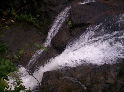
Along the way, we saw a lot of brooks which forge into each other to form the Ulhas river. But these were just small fry. The main stream of the river is a huge rivulet which announces itself in the form of huge waterfalls from the top of the mountain to the base. We chanced upon one such waterfall and spent around 15 minutes frolicking in its mighty splash. The flow was forceful and the sound defeaning. We were seeing the great river in its most vertical form!!!


We soon decided that we had enough fun and continued on towards the caves. We didnt take long to reach them. The caves had a huge yellowish portal with two big waterfalls acting like curtains. The main portal opened into a Buddish style temple with a damaged interiors. Again the sight of plastic waste greeted and irritated us. But the caves themselves were in good condition. There were rooms for traders to stay in and individual cabins for priests. Also there were water cisterns to store water. We inspected each and every part of our cave and enjoyingly discussed the structure and explained them to the first time trekkers, Pravin and Kamal. After we were convinced that we had seen enough of the caves we continued on toward Rajmachi.


Should we continue???:
The trek was mostly walking up rocks, but on the way opened out to two big plains which gave us an imposing views of the valley and the mountains which had the railway tracks and tunnels.


But all the trekking got Pravin really tired. After a particularly steep phase of climbing, we reached another plain where the path forked into three. At one corner of the plain, there was a small shelter made of thatched banana leaves. Our group was broken into two, with I and Yogesh racing along at a blistering pace and Nikhil and Kamal, proding a really battered and adamant Pravin along to the top. We must have waiting on that plane for 6 or 7 minutes before we saw Nikhil and Kamal emerge from the slopes to the plain, followed by Pravin who tottered straight to the shelter and sprawled to the ground. From here, we could see the Manranjan fortress at a much higher altitude and showed it to a cleary shaken Pravin. We had taken 4 hours for what should have been a three hour trek, so we clearly knew that we had to spend the night here, since trekking down at night could be really dangerous. Kamal was completely against staying overnight and wanted to return. Pravin looked too tired to continue. His first trek had almost done him in. So we all came in accord about having our packed lunch and doing an about turn. When our lunch was almost finished, we saw two school boys walking in the direction of the forts. We asked them about the distance to the fort and whether there was any accomodation available on the way. Their answer was the turning point of the entire trek. When they said that it was a mere half an hour to the fort, Pravin's ears perked up and he looked a completely transformed person, like a man possessed. The answer to the other question got us all going. There were indeed accomodating houses in the village Udhewadi nearby. Plus, the lunch had just recharged and rejuvenated us. However all these factors didnt mean much to Kamal, who still didnt like the idea of an overnight stay. He did however decide to come with us for the time being.
To Udhewadi:
After about 15 minutes of walking through grassland, pond banks and small streams, we arrived at the approach way to Udhewadi. The peculiarity of this village is that it has only 22 houses and the government didnt take the pain of laying electricity cables here. But they installed solar panels which provide electricity for a few hours in summer, but are futile in monsoon and cloud cover. On the left, a huge mountain rose up with a really majestic looking Manranjan fortress crowning it. On the other side were village fields. The path we were walking on was absolutely marshy and our shoes sank into it with each step. We ran into a man who was wearing a rain cover on his head and yelling out to a villager for help. He was yelling bcoz a young calf was stuck in the marsh and was too frightened to get up. So we decided to help him out instead of the person to whom he was calling out. We had to heave and push the timid creature out of its sitting posture and onto its feet. When we had almost encouraged the poor thing to continue, the owner reached the spot and started helping the calf to its home. He also offered us accomodation at his house if we were to stay overnight. At this point, we saw two guys coming back from their trek and returning to Karjat. Kamal who had been so comfortable with his health in this trek so far, decided to call it quits, since he didnt like the idea of an overnight stay and headed back. On the other hand, we accompanied the man to his house, already wondering how much it would cost. The man, Eknath Umbre, threw us another surprise which sealed the fate of our trek to confirmation. No more heading back. 20 rupees per head for accomodation and 40 rupees for food. Wow!! That was it. We took off our heavy bags and kept them at Eknath's hall. Then we had hot tea and Kanda Poha as snacks. Another huge group of trekkers also reached the house. They were to share the room with us. We ignored them for the time being and headed out towards the first of the twin forts, Shrivardhan.
A tour around Shrivardhan:
The path to Shrivardhan was a mud road leading off the village and climbing up to a small village temple. We had to continue along the path made along the front side of the temple and just follow. The path scaled pretty quickly and we made quick progress almost to the level of the fort. Then the path suddenly turned into a heavily eroded staircase which had lost a lot of its shape and was quite slippery. To add thrill to this fact, to the right of the staircase was a really yawning wide ravine and a slip here would have plunged us into the valley. But we carefully negotiated it and reached the main portal of the fort. The inside of the portal was filled with waist deep water which was very cold. We waded through it and reached the end of the portal section of the fort. As we came out, we came across a two storeyed water cistern, both filled to brim with water due to the heavy rains. The guys living here in the old days would never have had a water problem during monsoon. Immediately after the cistern was a series room suites cut into the rock. These were used by travellers in the old days to stay at the fort overnight. The rooms were cavernous and our voices echoed. It was particularly nerve-tingling to recite "Om" there as the voice absolutely reverberated off the thick stone walls. Having fooled around, we reached the point off our next ascent to the upper section or the watchdog section of the fort, called the Bale Killa. It was another ten minutes of climbing. The Bale Killa had a tall antenna which had a couple of wires attached to it. It might have been a flag post previously. After spending around 15 minutes discussing the fort, we headed back to Udhewadi to Eknath's.
To Shiv temple and lake:
We originally wanted to complete both the forts on one day, but it was getting dark, so we asked Eknath for other places to see. He recommended the Shiv temple and the lake nearby which reflected Shrivardhan on its surface. Quite photogenic!!! We headed to the temple. When we reached the lake, we saw a group swimming there. We also decided to swim. At first I was apprehensive bcoz of the cold, but I dove in anyway and swam for the next half and hour. I and Yogesh, being able swimmer went deep, but Pravin who couldnt swim remained in the shallow part. Nikhil was too cold and refused to come in and he couldnt swim anyway. After coming out of the water, I was surprised that the air outside felt warm, so my problem with the cold was over. We explored the temple and a nearby well which had a funny polyp kind of growth down the middle.


It looked really beautiful. When it was almost dusk, we headed back to Eknath's cottage.
Dinner and sleep:
We changed our wet clothes and hung them to dry. Then we had traditional Maharashtrian dinner and all the inmates, our group and the other group which shared the room with us, slept soundly that night in a room which was comfortably warm without any electricity.
Manranjan in morning:
Next morning after tea and Kanda Poha breakfast, we packed our bags isolating our wet clothes. The bags were ready, so that after we came back from Manranjan, we could just leave. We even paid Eknath our dues before we trekked to Manranjan.
We took a path to Manranjan which was a bit different from the prescribed one. But it was more fun and an ultra shortcut. However it was more dangerous, since it was less of a mud path, and more of slippery moss covered rocks. Pravin was frightened and irritable and we had fun at his expense, teasing and taunting him. However we reached the fort in ultra quick time. It was only when we were inside and surveying the place that we noticed exactly how huge this fortress was. There were lodging caverns, multiple water cisterns of cavernous sizes, temples, guard posts and a fortress wall which ran the entire length of the mountain. That wall is what is generally visible when we see the mountain from the depths of the Udhewadi to the left of the marshy path. We spent almost an hour walking around the area and realizing the very high significance of this fort in those days. After we returned back to 2008, we were ready to move. We trekked down the regular path and found it uninteresting and not thrilling at all. But Pravin was more at ease at least.
Back to Kondivade:
We took our bags from Eknath, thanked him profusely, took his contact details and left Rajmachi. I lost count of the number of times I gazed up at the forts while on the way down, from different angles and heights. On the trek down, we stopped at only place, that was one of the many plains that come along the path. This was a place with a view. From there we could the railway tracks across the valley and the many trains plying in a curvacious path winding around peaks and ravines.


Another hiccup that happened was that while returning we didnt come via the Kondane caves, but through another path that overlooked the caves from a much lower level. This was bcoz we lost the fork in the path somewhere. But it turned out better. We reached Kondivade much quicker along the plains. Instead of rocks, there were really beautiful fields here.


But we had to cross a shallow part of the Ulhas river to reach the village.
Along the way, we even saw the same shop where we had inquired about the way to the caves while on our way up. Now that shop was away from the path which we were taking.

But the paths joined and then things grew absolutely easy as we easily reached Kondivade village, taking some pictures along the way, where we caught a 6-seater back to Karjat west.

Back home:
We caught a Mumbai bound local train, got down at Kalyan, and I got a Titwala train to get back to home at Shahad. The most vivid image of this trip is on the plain where we found the banana leaf shelter. Actually the plain overlooked the mountain having Manranjan, but due to cloud and fog we couldnt see anything, but for just one fleeting moment, the skies suddenly cleared up showing us the majestic huge fort barricade running all along the mountain. Then the clouds came back. But that one fleeting moment of clarity had completely blown away all the tiredness and fatigue, replacing it with a burning longing to witness the ancient centuries old story inside the barricade.
Time required:
Karjat to Kondivade by 6-seater - 30 minutes or
Karjat to Khandape by bus - 25 minutes and Khandape to Kondivade by walk - 30 minutes
Kondivade to Udhewadi - 3 hours
Udhewadi to Shrivardhan - 30 minutes
Udhewadi to Manranjan - 30 minutes
Height: 813 metres (2710 feet)
Trekking experience required: No experience, this can be a beginner's trek.
Fitness required: Moderate fitness
Fear factor: Nothing upto Udhewadi. The ascent from Udhewadi to Shrivardhan has a stone staircase which has been eroded heavily by rain and can be a bit slippery during monsoon. To the right of the staircase is a very steep and deep ravine dropping straight into the village.
trek story:
India's 61st independence day brought us to the majestic twin forts of Rajmachi situated on the Bhor Ghats. The two forts Shrivardhan and Manranjan overlook each other from two mountains across a valley. Another mountain range across the valley to the east of Manranjan carries the railway tracks running from Mumbai to Pune. You can see the section of tracks running from Thakurwadi and Monkey Hill stations located between Karjat and Khandala. So on one side you see the ancient architectural wonder of strong stone fortresses and on the other side you see the magic of modern technology with strong rails of steel and massive moving boxes of steel which are parts of the most used and the highest revenue generating transport system of current India.
Introducting our new trekkers:
The Rajmachi trek introduces you to a new trekker in the form of Pravin Mohite, along with usual contributors of this blog. Pravin is responsible for most of the photography on this trip since my camera got waterlogged and wont start anymore :( Also coming with us on this trek was Kamal Bisht, but he couldnt complete the trek and left when we were about to reach Udhewadi, since he didnt want to stay overnight.
Upto Karjat by train:
All five of us met up at Kalyan, and from there we boarded the 7:07 am local train for Karjat, which after an uneventful run through the rainy morning reached Karjat at 8:15 am. We alighted and went to the east of the station to get to the Karjat bus stop.
Upto Kondivade by 6-seater:
From here we were to catch the bus to Sandshi and get down at a stop named Khandape. But we were too late and so we missed the bus, and found that the next bus was only at 9:50. That would have been too late and we would only have reached the base of the climb at around 11:00 or so. So we took a 6-seater directly to the base village of Kondivade. But the 6-seater charged us 250 rupees for 5 persons, and it was a rip off. We would like to tell you that you should not catch a 6-seater to Kondivade from Karjat east. Only do so from Karjat west and let all the seats fill up. The driver will tell you that he will take you there immediately without filling up the other seats and quote a price that is too high. But wait for the seats to fill up. The norm is that at Karjat, the seats are 'properly filled up' only when the 6-seater is carrying 12 persons!!! So be ready to adjust and sit squeezed with your bags on your lap!!! But then if that is the case, your fare will go down to Rs 8 per head, instead of the Rs 50 that we had to shell out. The best option would be to learn the timetable of buses in Karjat. Here I put up a reference chart that was put up at the Karjat bus stop itself. Use it as a reference chart for Rajmachi or Dhak Bahiri treks. Also note that the timings are as of 16th August 2008 at the latest. So keep tab on this time table.
Trek upto Kondane caves:
When we reached Kondivade, our 6-seater stopped at a point where the road was broken and unsafe to drive on.We got down and started walking towards the base of the climb. All along the way, the Ulhas river ran parallelly to the path we were walking on.
At one point, there was a section where the road had caved into the river, leaving a very narrow muddy strip for us to tip-toe on. The locals had tied a cable for everyone to hold onto while they negotiated the narrow strip. Once done, we moved on.
The river stopped following us and the paved road gave way to a muddy dirt path which reached upto the mountains. Along the way there were fields and criss crossing canals, one of which was a bit too broad to leap on, so a rudimentary, but a very beautiful bridge of wood sticks tied up with strong rope was stretched across the canal. It was sturdy enough for us to cross one by one.
We reached a point where the path forked into two more, one running left and the other straight on. We tentatively took the left path, where we saw a shop. There we asked for directions to Kondane caves and were told that the the path we were on would lead us to the caves and also would continue on to Rajmachi. So we continued on towards the path.
Along the way, we saw a lot of brooks which forge into each other to form the Ulhas river. But these were just small fry. The main stream of the river is a huge rivulet which announces itself in the form of huge waterfalls from the top of the mountain to the base. We chanced upon one such waterfall and spent around 15 minutes frolicking in its mighty splash. The flow was forceful and the sound defeaning. We were seeing the great river in its most vertical form!!!
We soon decided that we had enough fun and continued on towards the caves. We didnt take long to reach them. The caves had a huge yellowish portal with two big waterfalls acting like curtains. The main portal opened into a Buddish style temple with a damaged interiors. Again the sight of plastic waste greeted and irritated us. But the caves themselves were in good condition. There were rooms for traders to stay in and individual cabins for priests. Also there were water cisterns to store water. We inspected each and every part of our cave and enjoyingly discussed the structure and explained them to the first time trekkers, Pravin and Kamal. After we were convinced that we had seen enough of the caves we continued on toward Rajmachi.
Should we continue???:
The trek was mostly walking up rocks, but on the way opened out to two big plains which gave us an imposing views of the valley and the mountains which had the railway tracks and tunnels.
But all the trekking got Pravin really tired. After a particularly steep phase of climbing, we reached another plain where the path forked into three. At one corner of the plain, there was a small shelter made of thatched banana leaves. Our group was broken into two, with I and Yogesh racing along at a blistering pace and Nikhil and Kamal, proding a really battered and adamant Pravin along to the top. We must have waiting on that plane for 6 or 7 minutes before we saw Nikhil and Kamal emerge from the slopes to the plain, followed by Pravin who tottered straight to the shelter and sprawled to the ground. From here, we could see the Manranjan fortress at a much higher altitude and showed it to a cleary shaken Pravin. We had taken 4 hours for what should have been a three hour trek, so we clearly knew that we had to spend the night here, since trekking down at night could be really dangerous. Kamal was completely against staying overnight and wanted to return. Pravin looked too tired to continue. His first trek had almost done him in. So we all came in accord about having our packed lunch and doing an about turn. When our lunch was almost finished, we saw two school boys walking in the direction of the forts. We asked them about the distance to the fort and whether there was any accomodation available on the way. Their answer was the turning point of the entire trek. When they said that it was a mere half an hour to the fort, Pravin's ears perked up and he looked a completely transformed person, like a man possessed. The answer to the other question got us all going. There were indeed accomodating houses in the village Udhewadi nearby. Plus, the lunch had just recharged and rejuvenated us. However all these factors didnt mean much to Kamal, who still didnt like the idea of an overnight stay. He did however decide to come with us for the time being.
To Udhewadi:
After about 15 minutes of walking through grassland, pond banks and small streams, we arrived at the approach way to Udhewadi. The peculiarity of this village is that it has only 22 houses and the government didnt take the pain of laying electricity cables here. But they installed solar panels which provide electricity for a few hours in summer, but are futile in monsoon and cloud cover. On the left, a huge mountain rose up with a really majestic looking Manranjan fortress crowning it. On the other side were village fields. The path we were walking on was absolutely marshy and our shoes sank into it with each step. We ran into a man who was wearing a rain cover on his head and yelling out to a villager for help. He was yelling bcoz a young calf was stuck in the marsh and was too frightened to get up. So we decided to help him out instead of the person to whom he was calling out. We had to heave and push the timid creature out of its sitting posture and onto its feet. When we had almost encouraged the poor thing to continue, the owner reached the spot and started helping the calf to its home. He also offered us accomodation at his house if we were to stay overnight. At this point, we saw two guys coming back from their trek and returning to Karjat. Kamal who had been so comfortable with his health in this trek so far, decided to call it quits, since he didnt like the idea of an overnight stay and headed back. On the other hand, we accompanied the man to his house, already wondering how much it would cost. The man, Eknath Umbre, threw us another surprise which sealed the fate of our trek to confirmation. No more heading back. 20 rupees per head for accomodation and 40 rupees for food. Wow!! That was it. We took off our heavy bags and kept them at Eknath's hall. Then we had hot tea and Kanda Poha as snacks. Another huge group of trekkers also reached the house. They were to share the room with us. We ignored them for the time being and headed out towards the first of the twin forts, Shrivardhan.
A tour around Shrivardhan:
The path to Shrivardhan was a mud road leading off the village and climbing up to a small village temple. We had to continue along the path made along the front side of the temple and just follow. The path scaled pretty quickly and we made quick progress almost to the level of the fort. Then the path suddenly turned into a heavily eroded staircase which had lost a lot of its shape and was quite slippery. To add thrill to this fact, to the right of the staircase was a really yawning wide ravine and a slip here would have plunged us into the valley. But we carefully negotiated it and reached the main portal of the fort. The inside of the portal was filled with waist deep water which was very cold. We waded through it and reached the end of the portal section of the fort. As we came out, we came across a two storeyed water cistern, both filled to brim with water due to the heavy rains. The guys living here in the old days would never have had a water problem during monsoon. Immediately after the cistern was a series room suites cut into the rock. These were used by travellers in the old days to stay at the fort overnight. The rooms were cavernous and our voices echoed. It was particularly nerve-tingling to recite "Om" there as the voice absolutely reverberated off the thick stone walls. Having fooled around, we reached the point off our next ascent to the upper section or the watchdog section of the fort, called the Bale Killa. It was another ten minutes of climbing. The Bale Killa had a tall antenna which had a couple of wires attached to it. It might have been a flag post previously. After spending around 15 minutes discussing the fort, we headed back to Udhewadi to Eknath's.
To Shiv temple and lake:
We originally wanted to complete both the forts on one day, but it was getting dark, so we asked Eknath for other places to see. He recommended the Shiv temple and the lake nearby which reflected Shrivardhan on its surface. Quite photogenic!!! We headed to the temple. When we reached the lake, we saw a group swimming there. We also decided to swim. At first I was apprehensive bcoz of the cold, but I dove in anyway and swam for the next half and hour. I and Yogesh, being able swimmer went deep, but Pravin who couldnt swim remained in the shallow part. Nikhil was too cold and refused to come in and he couldnt swim anyway. After coming out of the water, I was surprised that the air outside felt warm, so my problem with the cold was over. We explored the temple and a nearby well which had a funny polyp kind of growth down the middle.
It looked really beautiful. When it was almost dusk, we headed back to Eknath's cottage.
Dinner and sleep:
We changed our wet clothes and hung them to dry. Then we had traditional Maharashtrian dinner and all the inmates, our group and the other group which shared the room with us, slept soundly that night in a room which was comfortably warm without any electricity.
Manranjan in morning:
Next morning after tea and Kanda Poha breakfast, we packed our bags isolating our wet clothes. The bags were ready, so that after we came back from Manranjan, we could just leave. We even paid Eknath our dues before we trekked to Manranjan.
We took a path to Manranjan which was a bit different from the prescribed one. But it was more fun and an ultra shortcut. However it was more dangerous, since it was less of a mud path, and more of slippery moss covered rocks. Pravin was frightened and irritable and we had fun at his expense, teasing and taunting him. However we reached the fort in ultra quick time. It was only when we were inside and surveying the place that we noticed exactly how huge this fortress was. There were lodging caverns, multiple water cisterns of cavernous sizes, temples, guard posts and a fortress wall which ran the entire length of the mountain. That wall is what is generally visible when we see the mountain from the depths of the Udhewadi to the left of the marshy path. We spent almost an hour walking around the area and realizing the very high significance of this fort in those days. After we returned back to 2008, we were ready to move. We trekked down the regular path and found it uninteresting and not thrilling at all. But Pravin was more at ease at least.
Back to Kondivade:
We took our bags from Eknath, thanked him profusely, took his contact details and left Rajmachi. I lost count of the number of times I gazed up at the forts while on the way down, from different angles and heights. On the trek down, we stopped at only place, that was one of the many plains that come along the path. This was a place with a view. From there we could the railway tracks across the valley and the many trains plying in a curvacious path winding around peaks and ravines.
Another hiccup that happened was that while returning we didnt come via the Kondane caves, but through another path that overlooked the caves from a much lower level. This was bcoz we lost the fork in the path somewhere. But it turned out better. We reached Kondivade much quicker along the plains. Instead of rocks, there were really beautiful fields here.
But we had to cross a shallow part of the Ulhas river to reach the village.
Along the way, we even saw the same shop where we had inquired about the way to the caves while on our way up. Now that shop was away from the path which we were taking.
But the paths joined and then things grew absolutely easy as we easily reached Kondivade village, taking some pictures along the way, where we caught a 6-seater back to Karjat west.
Back home:
We caught a Mumbai bound local train, got down at Kalyan, and I got a Titwala train to get back to home at Shahad. The most vivid image of this trip is on the plain where we found the banana leaf shelter. Actually the plain overlooked the mountain having Manranjan, but due to cloud and fog we couldnt see anything, but for just one fleeting moment, the skies suddenly cleared up showing us the majestic huge fort barricade running all along the mountain. Then the clouds came back. But that one fleeting moment of clarity had completely blown away all the tiredness and fatigue, replacing it with a burning longing to witness the ancient centuries old story inside the barricade.
Subscribe to:
Posts (Atom)