Time required:
Karjat to Kondivade by 6-seater - 30 minutes or
Karjat to Khandape by bus - 25 minutes and Khandape to Kondivade by walk - 30 minutes
Kondivade to Udhewadi - 3 hours
Udhewadi to Shrivardhan - 30 minutes
Udhewadi to Manranjan - 30 minutes
Height: 813 metres (2710 feet)
Trekking experience required: No experience, this can be a beginner's trek.
Fitness required: Moderate fitness
Fear factor: Nothing upto Udhewadi. The ascent from Udhewadi to Shrivardhan has a stone staircase which has been eroded heavily by rain and can be a bit slippery during monsoon. To the right of the staircase is a very steep and deep ravine dropping straight into the village.
trek story:
India's 61st independence day brought us to the majestic twin forts of Rajmachi situated on the Bhor Ghats. The two forts Shrivardhan and Manranjan overlook each other from two mountains across a valley. Another mountain range across the valley to the east of Manranjan carries the railway tracks running from Mumbai to Pune. You can see the section of tracks running from Thakurwadi and Monkey Hill stations located between Karjat and Khandala. So on one side you see the ancient architectural wonder of strong stone fortresses and on the other side you see the magic of modern technology with strong rails of steel and massive moving boxes of steel which are parts of the most used and the highest revenue generating transport system of current India.
Introducting our new trekkers:
The Rajmachi trek introduces you to a new trekker in the form of Pravin Mohite, along with usual contributors of this blog. Pravin is responsible for most of the photography on this trip since my camera got waterlogged and wont start anymore :( Also coming with us on this trek was Kamal Bisht, but he couldnt complete the trek and left when we were about to reach Udhewadi, since he didnt want to stay overnight.
Upto Karjat by train:
All five of us met up at Kalyan, and from there we boarded the 7:07 am local train for Karjat, which after an uneventful run through the rainy morning reached Karjat at 8:15 am. We alighted and went to the east of the station to get to the Karjat bus stop.
Upto Kondivade by 6-seater:
From here we were to catch the bus to Sandshi and get down at a stop named Khandape. But we were too late and so we missed the bus, and found that the next bus was only at 9:50. That would have been too late and we would only have reached the base of the climb at around 11:00 or so. So we took a 6-seater directly to the base village of Kondivade. But the 6-seater charged us 250 rupees for 5 persons, and it was a rip off. We would like to tell you that you should not catch a 6-seater to Kondivade from Karjat east. Only do so from Karjat west and let all the seats fill up. The driver will tell you that he will take you there immediately without filling up the other seats and quote a price that is too high. But wait for the seats to fill up. The norm is that at Karjat, the seats are 'properly filled up' only when the 6-seater is carrying 12 persons!!! So be ready to adjust and sit squeezed with your bags on your lap!!! But then if that is the case, your fare will go down to Rs 8 per head, instead of the Rs 50 that we had to shell out. The best option would be to learn the timetable of buses in Karjat. Here I put up a reference chart that was put up at the Karjat bus stop itself. Use it as a reference chart for Rajmachi or Dhak Bahiri treks. Also note that the timings are as of 16th August 2008 at the latest. So keep tab on this time table.

Trek upto Kondane caves:
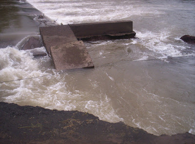
When we reached Kondivade, our 6-seater stopped at a point where the road was broken and unsafe to drive on.We got down and started walking towards the base of the climb. All along the way, the Ulhas river ran parallelly to the path we were walking on.


At one point, there was a section where the road had caved into the river, leaving a very narrow muddy strip for us to tip-toe on. The locals had tied a cable for everyone to hold onto while they negotiated the narrow strip. Once done, we moved on.
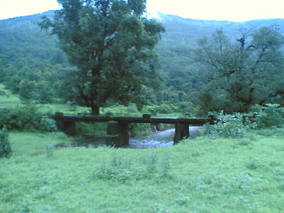
The river stopped following us and the paved road gave way to a muddy dirt path which reached upto the mountains. Along the way there were fields and criss crossing canals, one of which was a bit too broad to leap on, so a rudimentary, but a very beautiful bridge of wood sticks tied up with strong rope was stretched across the canal. It was sturdy enough for us to cross one by one.

We reached a point where the path forked into two more, one running left and the other straight on. We tentatively took the left path, where we saw a shop. There we asked for directions to Kondane caves and were told that the the path we were on would lead us to the caves and also would continue on to Rajmachi. So we continued on towards the path.
Along the way, we saw a lot of brooks which forge into each other to form the Ulhas river. But these were just small fry. The main stream of the river is a huge rivulet which announces itself in the form of huge waterfalls from the top of the mountain to the base. We chanced upon one such waterfall and spent around 15 minutes frolicking in its mighty splash. The flow was forceful and the sound defeaning. We were seeing the great river in its most vertical form!!!


We soon decided that we had enough fun and continued on towards the caves. We didnt take long to reach them. The caves had a huge yellowish portal with two big waterfalls acting like curtains. The main portal opened into a Buddish style temple with a damaged interiors. Again the sight of plastic waste greeted and irritated us. But the caves themselves were in good condition. There were rooms for traders to stay in and individual cabins for priests. Also there were water cisterns to store water. We inspected each and every part of our cave and enjoyingly discussed the structure and explained them to the first time trekkers, Pravin and Kamal. After we were convinced that we had seen enough of the caves we continued on toward Rajmachi.


Should we continue???:
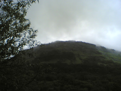
The trek was mostly walking up rocks, but on the way opened out to two big plains which gave us an imposing views of the valley and the mountains which had the railway tracks and tunnels.


But all the trekking got Pravin really tired. After a particularly steep phase of climbing, we reached another plain where the path forked into three. At one corner of the plain, there was a small shelter made of thatched banana leaves. Our group was broken into two, with I and Yogesh racing along at a blistering pace and Nikhil and Kamal, proding a really battered and adamant Pravin along to the top. We must have waiting on that plane for 6 or 7 minutes before we saw Nikhil and Kamal emerge from the slopes to the plain, followed by Pravin who tottered straight to the shelter and sprawled to the ground. From here, we could see the Manranjan fortress at a much higher altitude and showed it to a cleary shaken Pravin. We had taken 4 hours for what should have been a three hour trek, so we clearly knew that we had to spend the night here, since trekking down at night could be really dangerous. Kamal was completely against staying overnight and wanted to return. Pravin looked too tired to continue. His first trek had almost done him in. So we all came in accord about having our packed lunch and doing an about turn. When our lunch was almost finished, we saw two school boys walking in the direction of the forts. We asked them about the distance to the fort and whether there was any accomodation available on the way. Their answer was the turning point of the entire trek. When they said that it was a mere half an hour to the fort, Pravin's ears perked up and he looked a completely transformed person, like a man possessed. The answer to the other question got us all going. There were indeed accomodating houses in the village Udhewadi nearby. Plus, the lunch had just recharged and rejuvenated us. However all these factors didnt mean much to Kamal, who still didnt like the idea of an overnight stay. He did however decide to come with us for the time being.
To Udhewadi:
After about 15 minutes of walking through grassland, pond banks and small streams, we arrived at the approach way to Udhewadi. The peculiarity of this village is that it has only 22 houses and the government didnt take the pain of laying electricity cables here. But they installed solar panels which provide electricity for a few hours in summer, but are futile in monsoon and cloud cover. On the left, a huge mountain rose up with a really majestic looking Manranjan fortress crowning it. On the other side were village fields. The path we were walking on was absolutely marshy and our shoes sank into it with each step. We ran into a man who was wearing a rain cover on his head and yelling out to a villager for help. He was yelling bcoz a young calf was stuck in the marsh and was too frightened to get up. So we decided to help him out instead of the person to whom he was calling out. We had to heave and push the timid creature out of its sitting posture and onto its feet. When we had almost encouraged the poor thing to continue, the owner reached the spot and started helping the calf to its home. He also offered us accomodation at his house if we were to stay overnight. At this point, we saw two guys coming back from their trek and returning to Karjat. Kamal who had been so comfortable with his health in this trek so far, decided to call it quits, since he didnt like the idea of an overnight stay and headed back. On the other hand, we accompanied the man to his house, already wondering how much it would cost. The man, Eknath Umbre, threw us another surprise which sealed the fate of our trek to confirmation. No more heading back. 20 rupees per head for accomodation and 40 rupees for food. Wow!! That was it. We took off our heavy bags and kept them at Eknath's hall. Then we had hot tea and Kanda Poha as snacks. Another huge group of trekkers also reached the house. They were to share the room with us. We ignored them for the time being and headed out towards the first of the twin forts, Shrivardhan.
A tour around Shrivardhan:
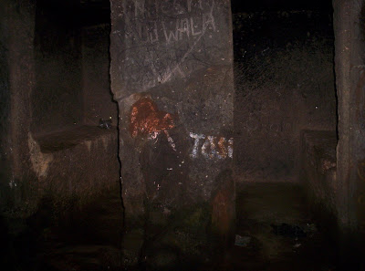
The path to Shrivardhan was a mud road leading off the village and climbing up to a small village temple. We had to continue along the path made along the front side of the temple and just follow. The path scaled pretty quickly and we made quick progress almost to the level of the fort. Then the path suddenly turned into a heavily eroded staircase which had lost a lot of its shape and was quite slippery. To add thrill to this fact, to the right of the staircase was a really yawning wide ravine and a slip here would have plunged us into the valley. But we carefully negotiated it and reached the main portal of the fort. The inside of the portal was filled with waist deep water which was very cold. We waded through it and reached the end of the portal section of the fort. As we came out, we came across a two storeyed water cistern, both filled to brim with water due to the heavy rains. The guys living here in the old days would never have had a water problem during monsoon. Immediately after the cistern was a series room suites cut into the rock. These were used by travellers in the old days to stay at the fort overnight. The rooms were cavernous and our voices echoed. It was particularly nerve-tingling to recite "Om" there as the voice absolutely reverberated off the thick stone walls. Having fooled around, we reached the point off our next ascent to the upper section or the watchdog section of the fort, called the Bale Killa. It was another ten minutes of climbing. The Bale Killa had a tall antenna which had a couple of wires attached to it. It might have been a flag post previously. After spending around 15 minutes discussing the fort, we headed back to Udhewadi to Eknath's.
To Shiv temple and lake:
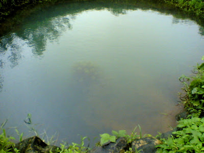
We originally wanted to complete both the forts on one day, but it was getting dark, so we asked Eknath for other places to see. He recommended the Shiv temple and the lake nearby which reflected Shrivardhan on its surface. Quite photogenic!!! We headed to the temple. When we reached the lake, we saw a group swimming there. We also decided to swim. At first I was apprehensive bcoz of the cold, but I dove in anyway and swam for the next half and hour. I and Yogesh, being able swimmer went deep, but Pravin who couldnt swim remained in the shallow part. Nikhil was too cold and refused to come in and he couldnt swim anyway. After coming out of the water, I was surprised that the air outside felt warm, so my problem with the cold was over. We explored the temple and a nearby well which had a funny polyp kind of growth down the middle.


It looked really beautiful. When it was almost dusk, we headed back to Eknath's cottage.
Dinner and sleep:
We changed our wet clothes and hung them to dry. Then we had traditional Maharashtrian dinner and all the inmates, our group and the other group which shared the room with us, slept soundly that night in a room which was comfortably warm without any electricity.
Manranjan in morning:
Next morning after tea and Kanda Poha breakfast, we packed our bags isolating our wet clothes. The bags were ready, so that after we came back from Manranjan, we could just leave. We even paid Eknath our dues before we trekked to Manranjan.
We took a path to Manranjan which was a bit different from the prescribed one. But it was more fun and an ultra shortcut. However it was more dangerous, since it was less of a mud path, and more of slippery moss covered rocks. Pravin was frightened and irritable and we had fun at his expense, teasing and taunting him. However we reached the fort in ultra quick time. It was only when we were inside and surveying the place that we noticed exactly how huge this fortress was. There were lodging caverns, multiple water cisterns of cavernous sizes, temples, guard posts and a fortress wall which ran the entire length of the mountain. That wall is what is generally visible when we see the mountain from the depths of the Udhewadi to the left of the marshy path. We spent almost an hour walking around the area and realizing the very high significance of this fort in those days. After we returned back to 2008, we were ready to move. We trekked down the regular path and found it uninteresting and not thrilling at all. But Pravin was more at ease at least.
Back to Kondivade:
We took our bags from Eknath, thanked him profusely, took his contact details and left Rajmachi. I lost count of the number of times I gazed up at the forts while on the way down, from different angles and heights. On the trek down, we stopped at only place, that was one of the many plains that come along the path. This was a place with a view. From there we could the railway tracks across the valley and the many trains plying in a curvacious path winding around peaks and ravines.


Another hiccup that happened was that while returning we didnt come via the Kondane caves, but through another path that overlooked the caves from a much lower level. This was bcoz we lost the fork in the path somewhere. But it turned out better. We reached Kondivade much quicker along the plains. Instead of rocks, there were really beautiful fields here.


But we had to cross a shallow part of the Ulhas river to reach the village.
Along the way, we even saw the same shop where we had inquired about the way to the caves while on our way up. Now that shop was away from the path which we were taking.

But the paths joined and then things grew absolutely easy as we easily reached Kondivade village, taking some pictures along the way, where we caught a 6-seater back to Karjat west.

Back home:
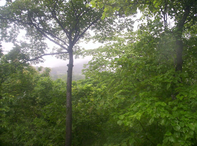
We caught a Mumbai bound local train, got down at Kalyan, and I got a Titwala train to get back to home at Shahad. The most vivid image of this trip is on the plain where we found the banana leaf shelter. Actually the plain overlooked the mountain having Manranjan, but due to cloud and fog we couldnt see anything, but for just one fleeting moment, the skies suddenly cleared up showing us the majestic huge fort barricade running all along the mountain. Then the clouds came back. But that one fleeting moment of clarity had completely blown away all the tiredness and fatigue, replacing it with a burning longing to witness the ancient centuries old story inside the barricade.